The New York Times Maps Out the Redesign — In Motion
The New York Times published a thorough interactive explainer of the redesign, breaking down — mode by mode — what actually changes when you close the road between the Arch and Prospect Park. Side-by-side maps for pedestrians, cyclists, bus riders, and drivers, with the source data straight from NYC DOT.
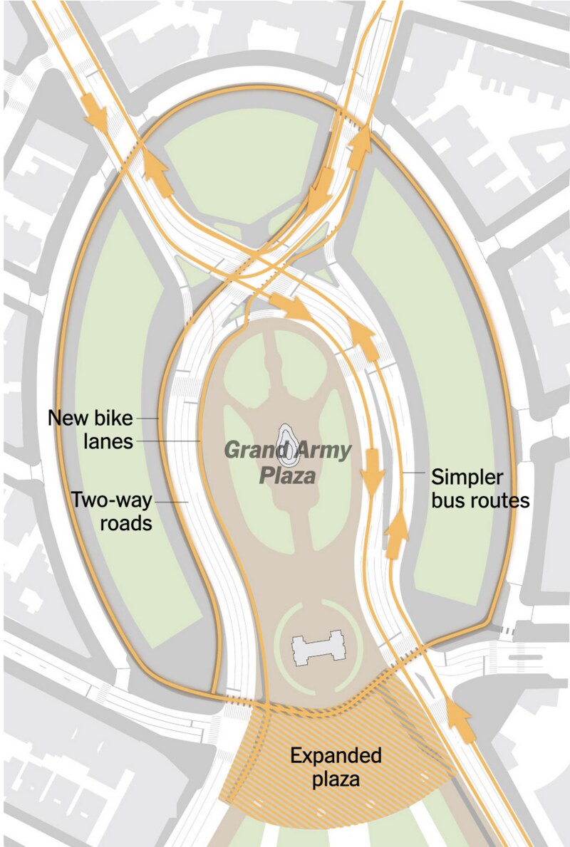
Here are the key comparisons. All graphics: The New York Times / NYC DOT. Read the original interactive →
Pedestrians: from islands to a continuous walk
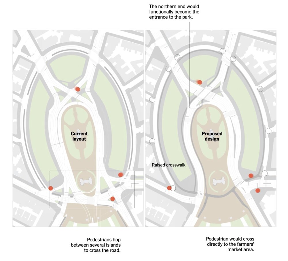
“The plan calls for reducing the total number of crossings for pedestrians and cyclists to 24, down from 39… The city also plans to raise 10 crosswalks, which would make them level with the curb and act as speed bumps for cars.”
The northern end of the plaza becomes the functional entrance to the park. Visitors to the public library no longer crowd onto tiny pedestrian islands with cars whizzing past.
The library crossing
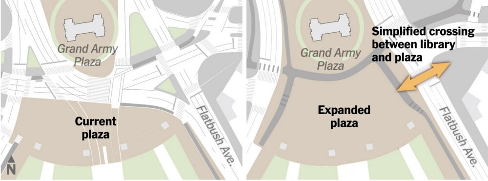
A simplified crossing between the library and the plaza — and three-quarters of an acre of new public space for the Greenmarket and seasonal events.
Bicycles: from disjointed paint to a connected network
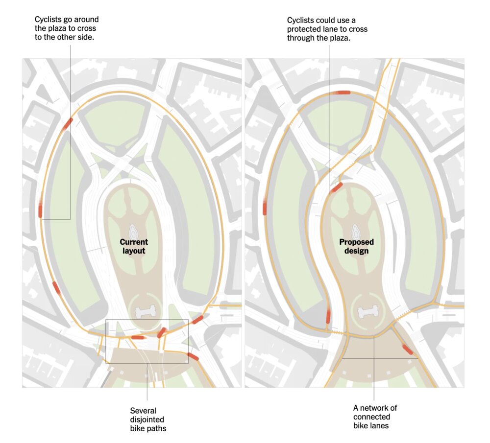
Today, cyclists go all the way around the plaza to cross to the other side. The proposal adds a protected lane straight through the plaza, with parking and landscaping as buffers.
“Protected bike lanes have been shown to reduce traffic injuries by 15 percent for everyone on the road, including drivers and pedestrians, according to a 2022 Department of Transportation study.”
Buses: simpler routes for the B41 and B69
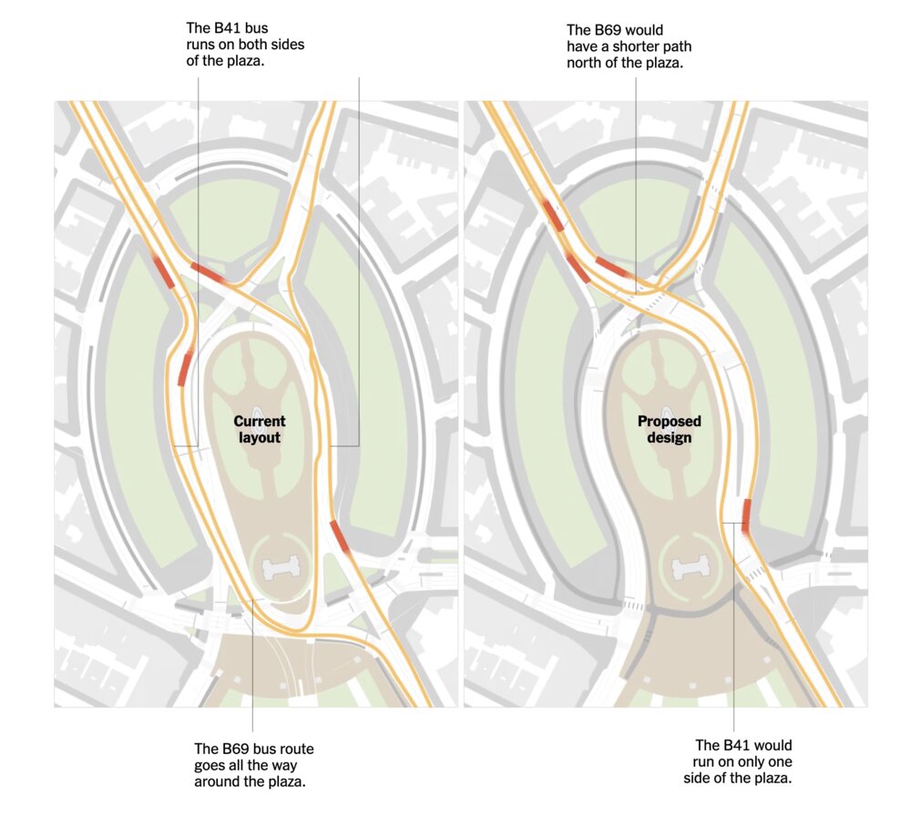
The inner ring becomes two-way. The B41 — one of the city’s busiest bus lines — sticks to the east side instead of looping. The B69 turns sooner, avoiding the jumble closest to the Arch. Center-running bus lanes on Flatbush Avenue further speed things up.
Cars: a longer detour, but smoother flow
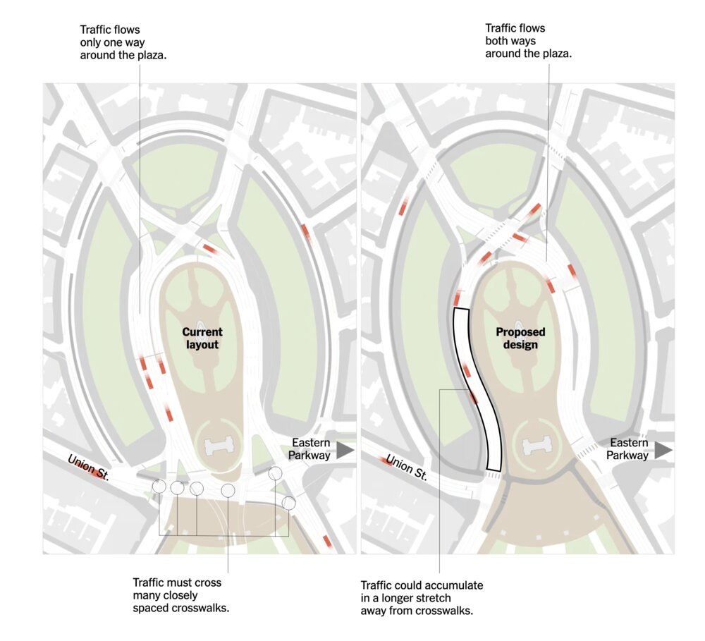
Drivers approaching from Union Street can no longer cut straight across to Eastern Parkway — they loop around a two-way inner ring instead. The Transportation Department says this actually makes driving smoother, because cars no longer bunch up around Union Street, and most plaza-area traffic uses Flatbush Avenue anyway.
The bottom line
Between 2020 and 2025, 219 people were injured along the plaza’s roadways. The redesign cuts crossings from 39 to 24, raises 10 of them, adds protected bike lanes, and reclaims three-quarters of an acre for public space.
The Times notes one open question: the city has not yet provided a timeline or budget, or committed to completing the work before the end of Mayor Mamdani’s first term. That’s where public pressure comes in.
Read the full NYT interactive →
Take the DOT survey → · Sign our petition →