The Research
The evidence behind pedestrian-first design — safety data, economic research, and health studies.
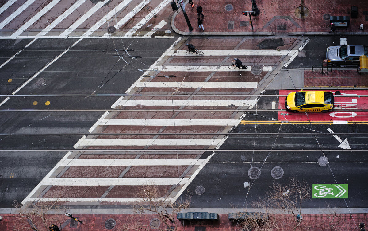
Safety
Redesigning streets for people dramatically reduces crashes and injuries.
Road Diets
Road diets (reducing lanes for cars) typically reduce crashes by 19–47%. The same principles apply to plaza redesigns that remove through-traffic and simplify crossings.
- FHWA Road Diet Informational Guide — Federal Highway Administration (2014)
London Low Traffic Neighbourhoods
A 2025 study of 113 London LTNs found 35% fewer injuries and 37% fewer deaths/serious injuries inside redesigned areas. When LTNs were removed, injury rates returned to pre-intervention levels. No overall increase in injuries on surrounding streets.
- Low Traffic Neighbourhoods in London reduce road traffic injuries — BMJ Injury Prevention (July 2025). DOI: 10.1136/ip-2024-045571
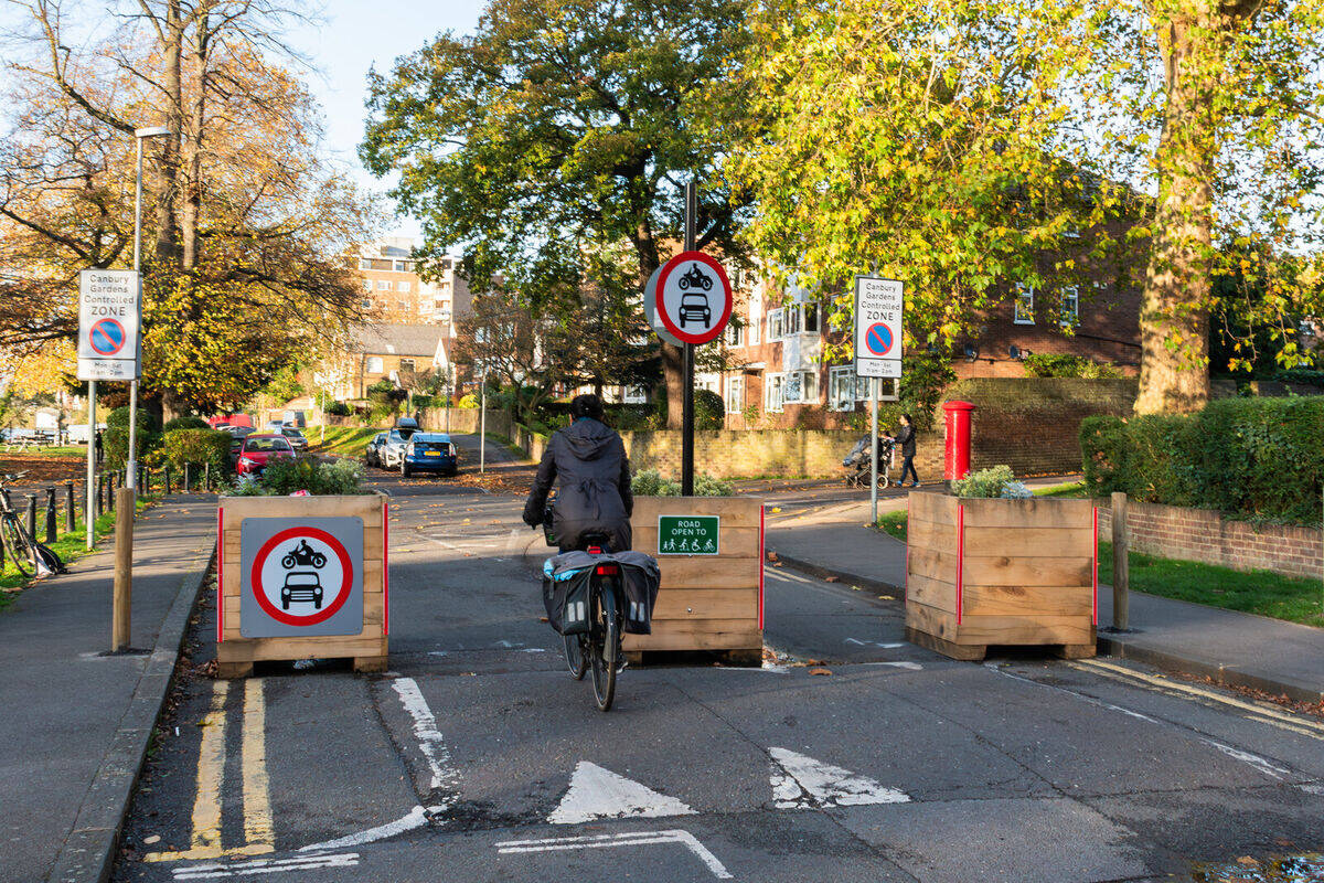 A modal filter in Kingston upon Thames — open to bikes and pedestrians, closed to cars. Photo: Jack Fifield / Wikimedia Commons / CC BY 2.0
At Grand Army Plaza
Flatbush Ave, Eastern Parkway, and St. Johns Place are all designated Vision Zero Priority Corridors. Between 2020 and 2025, there were 219 injuries on the plaza’s roadways — and 84% were motor vehicle occupants. The plaza isn’t just dangerous for pedestrians; it’s dangerous for everyone.
8.1% of the surrounding community has a disability — simplified crossings and fewer conflict points would directly improve accessibility for the tens of thousands of residents who navigate this space.
The redesign would:
- Eliminate the dangerous roadway between the Arch and the Park
- Cut crosswalks from 24 to 12 and intersections from 11 to 3
- Reduce conflict points where cars, bikes, and pedestrians mix
Economic Impact
People-friendly streets are good for business.
NYC DOT Research
NYC DOT’s own research shows that streetscape improvements lead to significant retail sales gains:
- Fordham Road (Bronx): 71% increase in retail sales at locally-based businesses vs. 23% borough-wide
- 9th Avenue (Manhattan): Up to 49% increase vs. 3% borough-wide
- St. Nicholas & Amsterdam Ave: 48% increase in local retail sales
Sources:
- Measuring the Street: New Metrics for 21st Century Streets (PDF) — NYC DOT (October 2012)
- The Economic Benefits of Sustainable Streets (PDF) — NYC DOT (2013)
Times Square
What started as a temporary pedestrian experiment in 2009 became permanent after data showed it worked: fewer crashes, increased foot traffic, and business support.
- Times Square Case Study — Project for Public Spaces
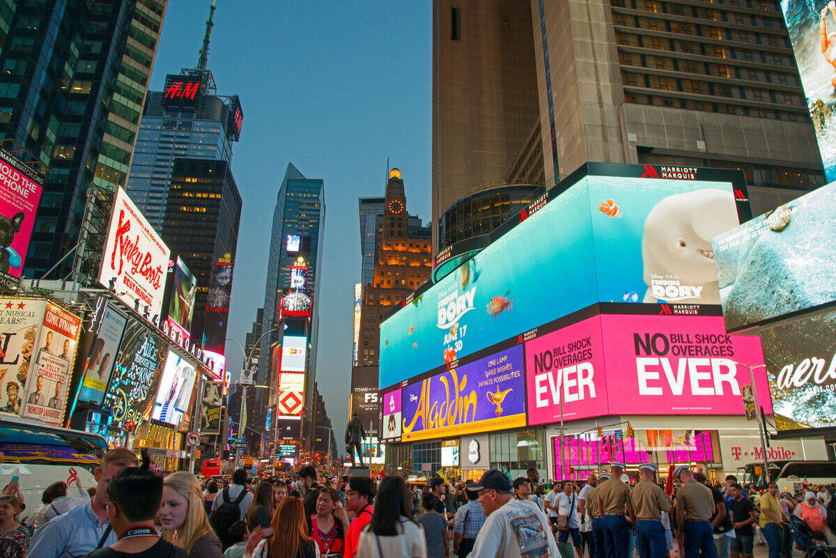 Times Square’s pedestrian plaza — once a traffic nightmare, now one of the most visited places in the world. Photo: Wikimedia Commons / CC BY-SA 4.0
Health & Environment
More space for walking means healthier communities.
Barcelona Superblocks
A health impact assessment of Barcelona’s Superblocks program projected that full implementation could prevent 667 premature deaths annually through reduced air pollution, noise, and heat, plus increased physical activity.
- Changing the urban design of cities for health: The superblock model — Environment International (January 2020). DOI: 10.1016/j.envint.2019.105132
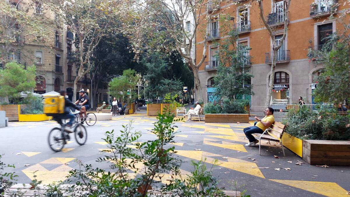 A Barcelona Superblock in Sant Antoni — former roadway now filled with trees, benches, and people. Photo: Wikimedia Commons / CC BY-SA 4.0
Seoul Cheonggyecheon
In 2005, Seoul removed an elevated highway and restored the stream underneath. Results:
- Corridor temperatures dropped 3.3–5.9°C
- Air quality improved (35% reduction in particulate matter)
-
Biodiversity increased 639%
- Cheonggyecheon Stream Restoration Project — Landscape Performance Series
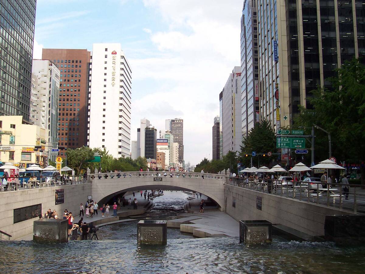 Seoul’s Cheonggyecheon stream — an elevated highway was removed in 2005 to restore this. Photo: Wikimedia Commons / CC BY-SA 3.0
Open Streets Programs
A 2023 study of 15 Latin American cities documented health benefits from Ciclovía/Open Streets programs, which temporarily close streets to cars for recreation and exercise.
- Health benefits of Open Streets programmes in Latin America — The Lancet Planetary Health (July 2023). DOI: 10.1016/S2542-5196(23)00109-2
NYC Policy & Guidance
- Vision Zero — NYC’s program to eliminate traffic deaths
- NYC Streets Plan — Five-year plan (Local Law 195/2019) for safe, accessible streets
- NYC Street Design Manual — Official guidance for plazas, bike facilities, and accessibility
- Street Design Manual (PDF) — Full downloadable version
It Already Works
Car-free plazas are thriving — in our neighborhood, across NYC, and around the world. The projects most like Grand Army Plaza are traffic circles and roundabouts that were converted into pedestrian space.
Grand Army Plaza isn’t a local quirk — it’s part of a global movement. From Paris to Barcelona to Times Square, cities are reclaiming car-dominated intersections as public space, and the results keep proving the skeptics wrong.
Paris “Seven Squares” Program
Between 2016 and 2024, Mayor Hidalgo committed to redesigning seven major Parisian plazas, each dedicating at least 50% of space to pedestrians, cyclists, and public life. The results at Bastille and République (below) demonstrate what’s possible when a city commits to its public squares.
Place de la Bastille, Paris
The closest international analogue to Grand Army Plaza. Between 2019–2021, Paris removed the major roadway on the south side of the Bastille roundabout, creating a new pedestrian plaza around the July Column.
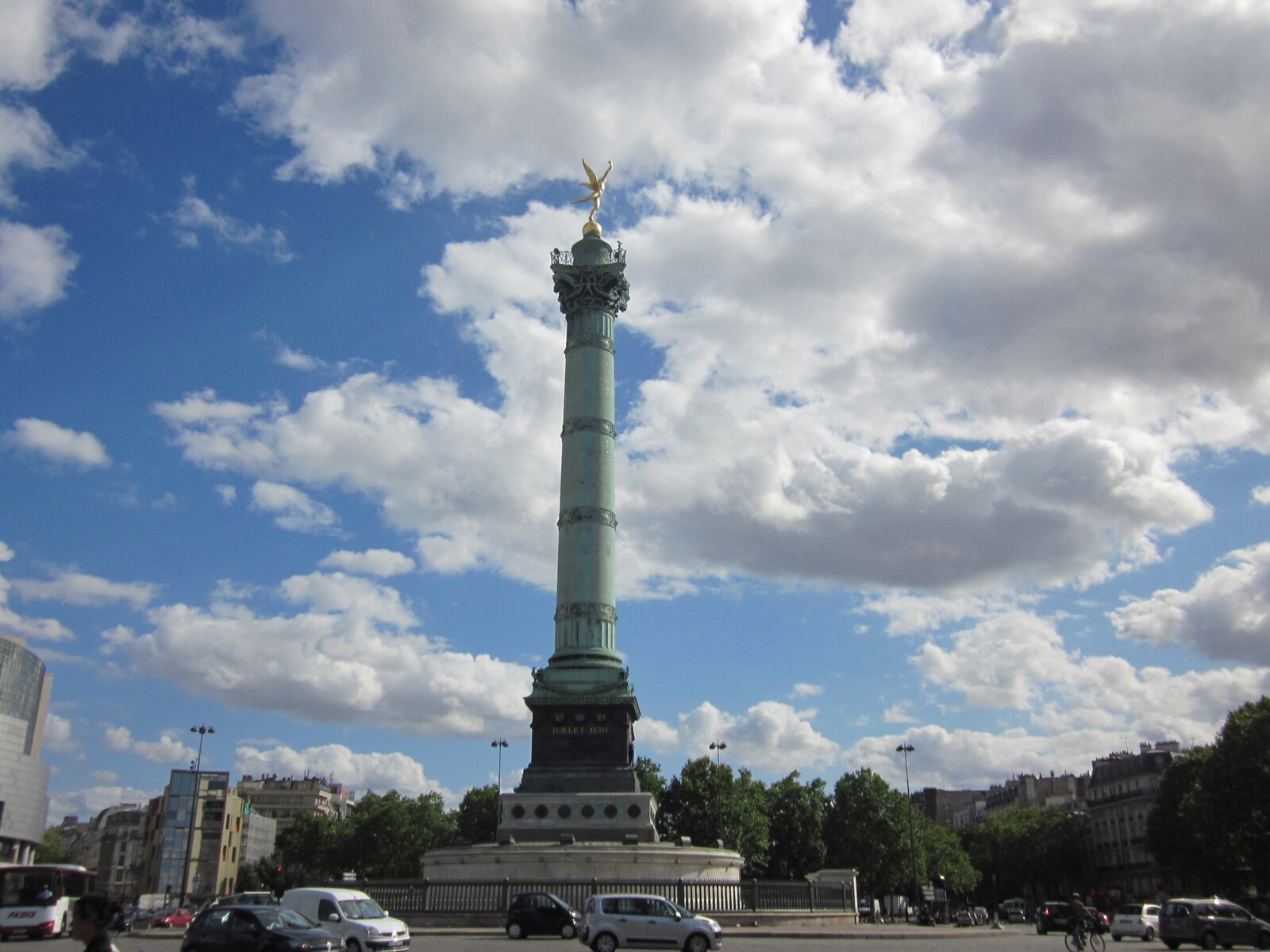 Place de la Bastille before the redesign — a car-dominated roundabout, much like Grand Army Plaza today. Photo: Wikimedia Commons
- Paris to Return Its Great Public Squares to the People — Streetsblog
Place de la République, Paris
Completed in 2013, Place de la République was transformed from a “glorified roundabout” into a pedestrian-focused square. 70% of the 3.4-hectare square is now reserved for pedestrians, with only 30% for vehicles. Finalist for the European Prize for Urban Public Space.
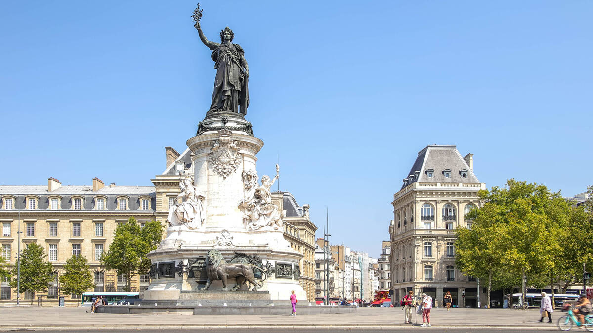 Place de la République after redesign — formerly a roundabout, now a pedestrian plaza. Photo: Wikimedia Commons / CC BY-SA 4.0
- Place de la République — Wikipedia
Seine Riverbank, Paris
In 2016–2017, Paris permanently closed the Voie Georges-Pompidou, a 13km expressway along the Seine, removing 43,000 cars per day. The riverbanks are now Parc Rives de Seine — a park for pedestrians and cyclists. Paris-Plages (summer beach program) draws 4M+ visitors annually.
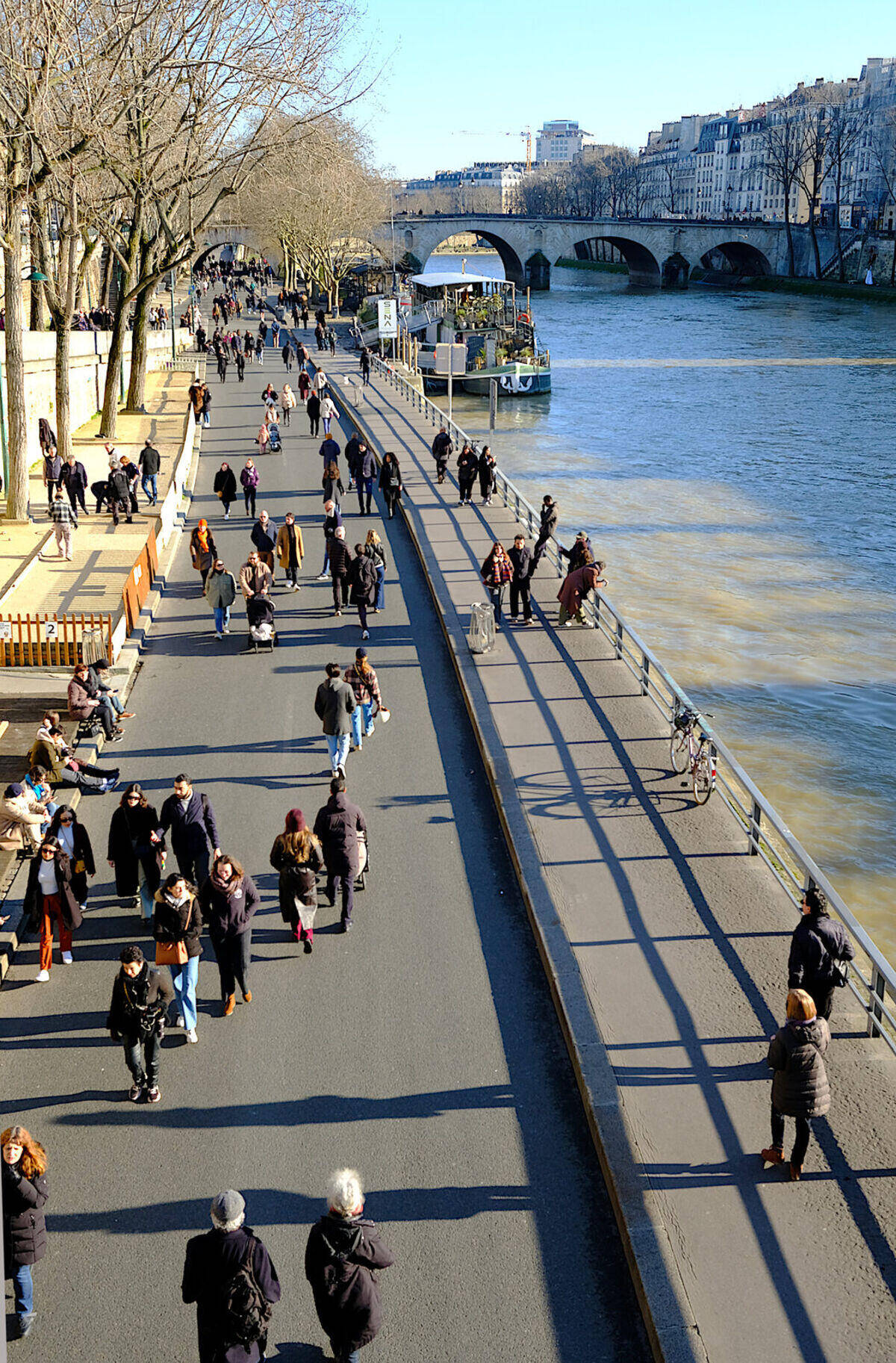 Parc Rives de Seine — this was a highway carrying 43,000 cars/day. Photo: Wikimedia Commons / CC BY-SA 4.0
- Voie Georges-Pompidou — Wikipedia
Times Square, NYC
What started as a temporary pedestrian experiment in 2009 became permanent after data showed it worked: fewer crashes, increased foot traffic, and business support. Part of the “Green Light for Midtown” initiative that also pedestrianized Herald Square and Madison Square.
Times Square’s pedestrian plaza — once a traffic nightmare, now one of the most visited places in the world. Photo: Wikimedia Commons / CC BY-SA 4.0
- Times Square Case Study — Project for Public Spaces
Herald Square & Flatiron Plazas, NYC
Also part of “Green Light for Midtown,” NYC DOT closed segments of Broadway at Herald Square (33rd–35th St) and Madison Square (23rd–25th St) in 2009, creating pedestrian plazas with seating, tables, and programming. Pedestrian space more than doubled. Injuries decreased. A 2019 expansion closed additional blocks.
 Herald Square pedestrian plaza — formerly Broadway traffic lanes. Photo: Wikimedia Commons / CC BY-SA 4.0
Corona Plaza, Queens
In 2012, NYC DOT converted a service road next to the 103rd St stop on the 7 train into a pedestrian plaza. The space had been an informal parking lot. It was “packed with families, children, and shoppers” on opening weekend and unanimously approved by the community board.
NYC DOT Plaza Program & Broadway Vision
NYC DOT has created 22+ pedestrian plazas through its Plaza Program since 2008, converting underused roadway into public space across all five boroughs. The latest expansion is Broadway Vision ($150M+, 2024–2031), redesigning Broadway from Union Square to Columbus Circle. Grand Army Plaza isn’t an experiment — it’s an extension of proven city policy.
- NYC DOT Plaza Program — NYC DOT
NYC Comptroller: Streets for People
The NYC Comptroller’s office published a report validating open streets and plaza conversions citywide, finding broad public support and measurable safety and economic benefits. The report recommends expanding the program — exactly what Grand Army Plaza would do.
- Streets for People — NYC Comptroller
At Grand Army Plaza
The Grand Army Plaza Greenmarket operates year-round, every Saturday. In DOT’s 2022 survey, 79% of 2,077 respondents said programming like the Greenmarket is the best thing about Grand Army Plaza — even with today’s dangerous crossings. Every New Year’s Eve, thousands gather at the plaza for Brooklyn’s official celebration and fireworks.
In the Neighborhood
Vanderbilt Avenue, just blocks away, operates as a car-free open street on weekends with community and business support. Vanderbilt Ave →
In 2023, DOT opened Underhill Plaza — the first permanent open-street-to-plaza conversion in Prospect Heights. Crashes on Underhill dropped 39% after the conversion. Underhill Plaza →
Car-Free Central Park & Prospect Park
Both parks went permanently car-free in recent years. The results: safer conditions, more space for recreation, and no traffic problems on surrounding streets.
Market Street, San Francisco
San Francisco’s main commercial street has been progressively removing private vehicle access since 2020. Evaluations show improved transit reliability and safety.
 Market Street, San Francisco — progressively removing private cars since 2020. Photo: Wikimedia Commons / CC BY-SA 4.0
Recent Investments at Grand Army Plaza
Arch Restoration (2025)
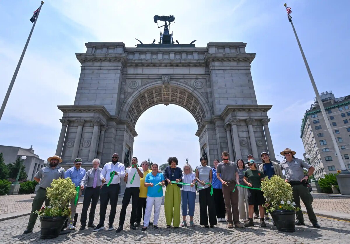 The $8.9M arch restoration ribbon cutting. Photo: Prospect Park Alliance
The Soldiers’ & Sailors’ Memorial Arch just completed an $8.9 million restoration: new roof, structural and masonry repairs, interior metalwork, and upgraded lighting. Arch restoration →
Brooklyn Public Library Renovation
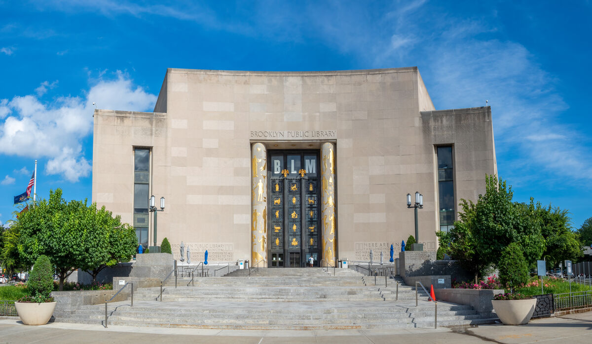 The Central Library’s Art Deco entrance faces Grand Army Plaza
The Central Library at Grand Army Plaza is in Phase 2 of a $95 million renovation, expanding public-facing spaces and creating new community areas. Expected completion: 2027. BPL renovation →
The Moment Is Now
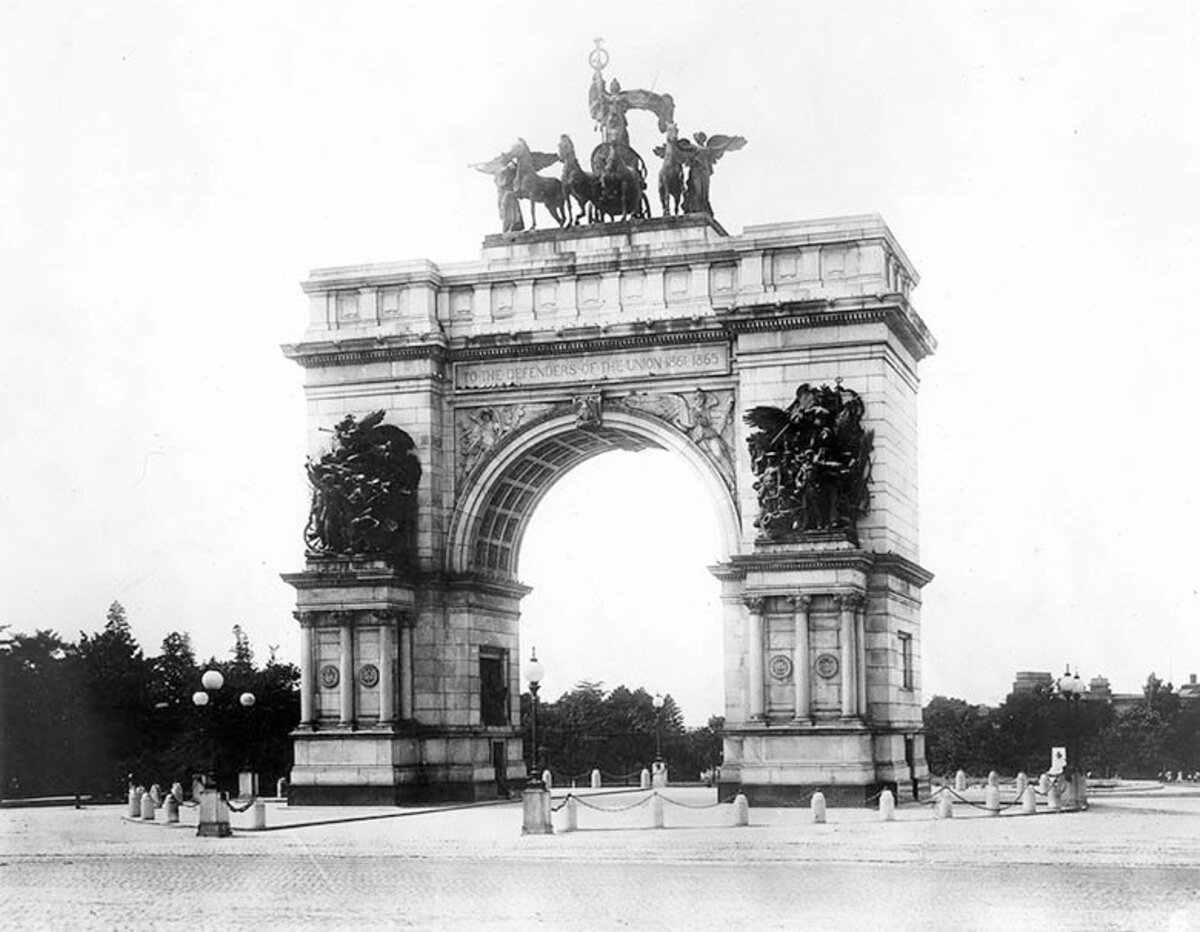 The arch circa 1905 — before cars took over. Photo: Prospect Park Alliance Archives
The pieces are in place. The Arch is restored ($8.9M, completed 2025). The Library is expanding ($95M, completing 2027). The plaza redesign is advancing (2026). Three major public investments converging for the first time — and a twenty-year community fight finally reaching its moment. Now is the time to complete the vision.
Partner Organizations
- Prospect Park Alliance — Stewards of Prospect Park
- Brooklyn Public Library — Central Library at Grand Army Plaza
- Transportation Alternatives — NYC streets advocacy
Official Contacts
City Council
- District 35 (Crystal Hudson): District35@council.nyc.gov
- District 39 (Shahana Hanif): District39@council.nyc.gov
Community Boards
- CB6 (Park Slope, Gowanus): bk06@cb.nyc.gov
- CB8 (Crown Heights, Prospect Heights): bk08@cb.nyc.gov
- CB9 (Crown Heights, PLG): bk09@cb.nyc.gov
NYC DOT
- Community Engagement: community@dot.nyc.gov
Support the Campaign
Missing something? Email us at hello@grandarmyredesign.com